Schouten Passage and Schouten Island
Sea area · Salt water · in Tasmania
A deep channel with strong currents between the Freycinet Peninsula and Schouten Island, at the seaward end of Great Oyster Bay, and the open water round the island beyond it. The 2008 article says heavy sinkers are needed to fish the bottom in the passage, and that the southern tip and eastern shores of the island are the most productive for tuna. It is a run of fifteen kilometres or more from the ramps in the bay.
FishingHQ describes what this place is, not whether you may fish it. Access, permits and who to ask.
What you can catch here
Documented at this place, grouped by how you would be fishing, with how strongly the sources support each one. This is what has been written down, not a forecast, and being listed is never permission to fish.
From a boat · 4
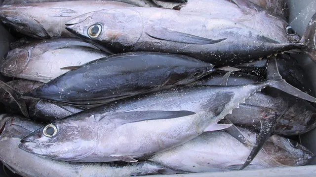 AlbacoreRegular local target1 placeSchouten Passage and Schouten IslandOver sea area
Photo: Joachim Langeneck, via Wikimedia Commons, CC BY-SA 4.0; resized and trimmed to fit; shared under the same licence
- Blue sharkRecorded here1 placeSchouten Passage and Schouten IslandOver sea area
- Striped trumpeterOccasional1 placeSchouten Passage and Schouten IslandOver sea area
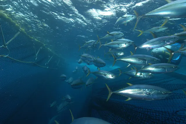 Yellowfin tunaOccasional1 placeSchouten Passage and Schouten IslandOver sea area
Photo: Marc Taquet, via Wikimedia Commons, CC BY 4.0; resized and trimmed to fit


What these strengths mean
- Regular local target
- Fishing sources describe this as a normal local target here, not merely as caught.
- Recorded here
- At least one credible public account of this species being caught here. That is all it means.
- Occasional
- Caught here, and described as unusual rather than normal. Do not plan a session around it.
- How breadth is counted
- A fish documented at six marks is shown as six marks: breadth never raises the strength on its own. A fishery account describes the fishing; a recorded catch reports one specific catch. How evidence is weighed.
How people fish it
Practised here: Sea fishing.
Methods the sources name for this ground. Each one is explained in full on its own page.
- Trolling
Towing lures or baits behind a moving boat to cover large volumes of water and locate scattered fish.
Baits and lures for these fish
The baits and lures each of the fish above is commonly taken on, from that fish’s own page. This is what works for the fish, not a report of what people use on this particular water — local knowledge and the conditions on the day still decide.
Lures
- Metal jigs — for Yellowfin tuna
- Saltwater lures — for Yellowfin tuna
The ground and the water
- The ground
- A deep channel with strong currents between the Freycinet Peninsula and Schouten Island, at the seaward end of Great Oyster Bay, and the open water round the island beyond it. The 2008 article says heavy sinkers are needed to fish the bottom in the passage, and that the southern tip and eastern shores of the island are the most productive for tuna. It is a run of fifteen kilometres or more from the ramps in the bay.
- Exposure
- The passage runs hard, and the water beyond it is open to the Tasman Sea; the article gives the length of the run as the reason more boats do not make it.
Rules and access
Particular to this water: This record rests on articles from 2008 and 2013 and describes what was reported then. Nothing here states that a spot is open or can still be reached. Tasmania's sea fishing rules, area restrictions and closed seasons are set by the state and change: check the current position with Fishing Tasmania before fishing. The island and the peninsula are inside a national park.
Beyond what is stated above, FishingHQ does not know the current access position here. Tasmania sets its own sea fishing rules: bag, possession and size limits that differ by zone for some fish, a seasonal closure for at least one species, shark refuge areas where sharks, skates and rays may not be taken, marine reserves where no fishing is allowed, and licences for some kinds of gear. The state also publishes health advice against eating fish or shellfish from named estuaries. All of it changes. Check the current position with Fishing Tasmania before going.
Who holds the answer:
- Fishing Tasmania, the state government's recreational sea fishing service, which publishes the rules, area restrictions and seasons.
- The state public health service, for advice on eating fish and shellfish from particular waters.
- Fishing Tasmania, the state's marine fisheries service, which issues recreational sea licences and publishes the sea fishing rules, seasons and area restrictions.
- Service Tasmania, whose shops sell both agencies' licences.
- Fishing Tasmania (Tasmanian Government): publishes the sea fishing rules, area restrictions and seasons for this water.
Nearby fishing
Other publicly documented places within about 40 km, by distance. Positions are approximate public geography and are never exact marks.
- Great Oyster Bay — 10–25 km · Bay
Sources for this place
- Tasmanian Fishing and Boating News: Great Oyster Bay and Swansea — Tasfish.com (Tasmanian Fishing and Boating News), 2013 (Specialist angling publication)Relied on for: The 2008 and 2013 articles on Great Oyster Bay and Swansea: the fish they report, to species where they give one, how they are fished for and where.States this directlyPassage read and verified
How FishingHQ labels evidence is explained in the evidence policy. Last reviewed 2026-10-10.
Something wrong or out of date?
If something on this page has changed, email us from your own account using the link that fits, with a link to where you saw the change if you can. Every report is checked by a person before anything is changed, and a report never appears on the site by itself. Please don’t send exact private marks.
Before you go
- Fish documented here
- 4 at this place itself. See them.
- Getting there
- Not recorded. FishingHQ holds no sourced description of the way in.
- Rules particular to this water
- This record rests on articles from 2008 and 2013 and describes what was reported then. Source not tied: no recorded source has been matched to this statement.
- Nothing here states that a spot is open or can still be reached. Source not tied: no recorded source has been matched to this statement.
- Tasmania's sea fishing rules, area restrictions and closed seasons are set by the state and change: check the current position with Fishing Tasmania before fishing. Source not tied: no recorded source has been matched to this statement.
- The island and the peninsula are inside a national park. Source not tied: no recorded source has been matched to this statement.
Nothing here is watched for change. Sources and who to ask.
- Hazards particular to this place
- None recorded for this place; the hazards of the wider coast or water still apply.
Check before you travel
- Whether you may fish here, and whether a licence or permit is needed — start with Fishing Tasmania.
- The tide times and the forecast for the day you go.
- Anything recorded here was true when it was read; it is not watched for change.