The south-east coast of La Gomera
Cliff coast · Salt water
Steep cliff and boulder coast on the sheltered side of the island, broken by the valley mouths at Playa de Santiago and San Sebastián, with very little walkable shore between them.
Safety: cliffs and rock platforms — can cause serious injury or death. 2 more points apply here.
FishingHQ describes what this place is, not whether you may fish it. Access, permits and who to ask.
What you can catch here
Documented at this place, grouped by how you would be fishing, with how strongly the sources support each one. This is what has been written down, not a forecast, and being listed is never permission to fish.
From the shore · 1
From a boat · 1
Spearfishing · 3
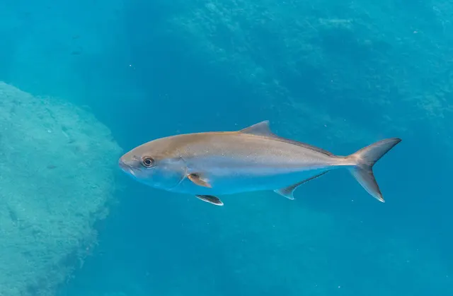
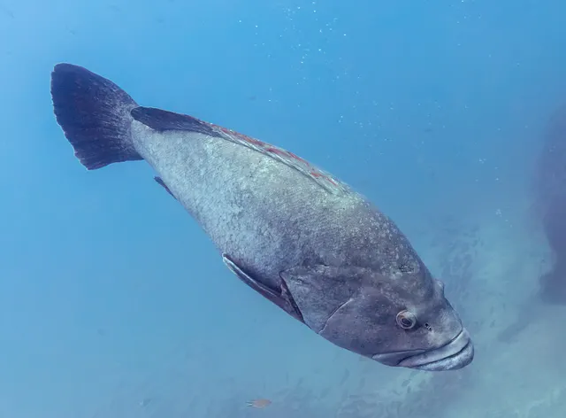
What these strengths mean
- Recorded here
- At least one credible public account of this species being caught here. That is all it means.
- Occasional
- Caught here, and described as unusual rather than normal. Do not plan a session around it.
- How breadth is counted
- A fish documented at six marks is shown as six marks: breadth never raises the strength on its own. A fishery account describes the fishing; a recorded catch reports one specific catch. How evidence is weighed.
Fish documented nearby, not here
Nothing below has been documented at The south-east coast of La Gomera itself. Each one has been documented at a named place on the same ground, and the places are listed with it. Treat this as what the water around here holds rather than as a catch list for this mark.
Widely documented on this ground
Documented at three or more neighbouring places, fished a way this place is also fished. That is a pattern about the ground rather than about any one mark, and it is the closest this site comes to saying you will probably meet a fish somewhere nothing has been written about.
From the shore
- Mediterranean parrotfish — documented at Valle Gran Rey; Playa de Santiago; San Sebastián de La Gomera
- Comber — documented at Valle Gran Rey; Playa de Santiago; San Sebastián de La Gomera
Also documented at neighbouring places
One or two accounts each, on the ground around here. Enough to know the fish is caught in these waters; not enough to say anything about this place.
From the shore
- Bogue — documented at Playa de Santiago; San Sebastián de La Gomera
- Salema porgy — documented at Valle Gran Rey; San Sebastián de La Gomera
How people fish it
Practised here: Sea fishing, Spearfishing.
Methods the sources name for this ground. Each one is explained in full on its own page.
- Shore diving
Entering and leaving the water from land under your own power — the most accessible spearfishing and the one where the entry and exit are the dangerous part.
- Boat diving
Spearfishing from a vessel, which removes the swim and adds the two things most likely to kill a diver: propellers and drift.
The ground and the water
- The ground
- Steep cliff and boulder coast on the sheltered side of the island, broken by the valley mouths at Playa de Santiago and San Sebastián, with very little walkable shore between them.
- Exposure
- The island's lee, and the reason the fishing and the diving are both concentrated here.
- Depth
- Among the steepest in the archipelago: great depth within a very short distance of the rock, which is what Canary sources name this coast for.
Safety
Cliffs and rock platforms — Can cause serious injury or death
Anglers are swept from rock platforms by individual large sets rather than by the average sea, which means the conditions that kill frequently look survivable for the twenty minutes before they arrive. Wet rock, weed and a swell running onto a sloping platform remove any chance of recovery.
What reduces it: Watch the water for a full set cycle before committing to a position, know the escape route and how long it takes, wear a flotation aid rather than carry one, never fish a platform alone, and treat a rising swell forecast as a reason not to go rather than a reason to be careful.
Drowning and immersion — Can cause serious injury or death
Mediterranean rock shores drop into deep water within a body length of the edge, so a slip puts somebody into water they cannot stand up in, frequently with no beach within reach and nobody in sight.
What reduces it: Wear a flotation aid rather than carry one, fish rock ground with somebody else, carry a means of calling for help on the person, and treat wet or weeded rock at the water's edge as unusable rather than as careful ground.
Sun, dehydration and fatigue — Can cause injury needing treatment
Long summer sessions on shadeless rock produce dehydration and heat exhaustion, and both degrade judgement and coordination well before they produce collapse, on ground where both are what keep somebody safe.
What reduces it: Carry substantially more water than the session appears to need, fish the ends of the day rather than the middle of it in high summer, and treat shade and a stopping time as part of the plan.
Rules and access
FishingHQ does not know the current access position here. The Canary Islands are an autonomous community licensing their own recreational sea, boat and underwater fishing, separately from mainland Spain, and the archipelago carries marine reserves in which fishing and diving are restricted or prohibited on boundaries a visitor cannot see from the shore. Measures change. Check the current position with the Canarian government's fisheries administration before going.
Particular to this water: A Canary recreational fishing licence is required, separately for shore, boat and underwater fishing. FishingHQ does not hold the current requirements — check with the Canary regional fisheries authority before fishing. Underwater fishing is licensed and regulated separately from rod fishing throughout this jurisdiction, with its own age, equipment and distance requirements, and holding a rod licence is not permission to spearfish.
Who holds the answer:
- The Canarian government's fisheries administration, which licenses recreational sea and underwater fishing in the archipelago.
- The island council, for local measures and for access to the coast.
- The marine reserve administration, where the water is inside a reserve.
- The regional Canarian government fisheries administration, for recreational licences, sizes and species rules
- The Spanish national maritime and fisheries authorities, for offshore and vessel matters
- The managing authority of any marine protected area or reserve, whose zoning governs what is permitted inside it
- Local dive centres, charter operators and clubs, for current practice and access on individual islands
Nearby fishing
Other publicly documented places within about 40 km, by distance. Positions are approximate public geography and are never exact marks.
- Playa de Santiago — under 2 km · Harbour wall
- La Gomera — 5–10 km · Island
- San Sebastián de La Gomera — 10–25 km · Harbour wall
- Valle Gran Rey — 10–25 km · Harbour wall
Sources for this place
- EMODnet — the European Marine Observation and Data Network — The European Commission, assembled from the national hydrographic offices, geological surveys and marine institutes of the member states (Scientific institute)Relied on for: Charted bathymetry, seabed substrate and seabed habitat for European sea areas, assembled from the national hydrographic and geological surveys, at the resolution the product publishes.States this directlyCitation checked — the work exists and is described correctly
- The European Environment Agency's assessments of Europe's waters, seas and coasts — European Environment Agency, Copenhagen (Conservation authority)Relied on for: Assessment of Europe's coasts and regional seas, including the condition of coastal water bodies, the pressures recorded on them and the coverage of designated sites.Background and mechanism onlyCitation checked — the work exists and is described correctly
- Canary Islands regional angling guidance sites — Various Canary-based angling and island guidance publishers (Credible secondary source)Relied on for: Island-by-island Spanish-language guidance naming the coasts, moles, harbours and beaches that are fished from the shore in the Canaries, and the species presented as local shore species at them.States this directlyCitation checked — the work exists and is described correctly
- Canary Islands angling community and forum material — Public Canary angling forums and community postings (Practitioner report)Relied on for: Public Canary angling community accounts naming specific marks and describing the ground at them, treated as evidence that a mark is genuinely fished and as nothing else.FishingHQ's interpretation of what it saysCitation checked — the work exists and is described correctly
- Canary Islands marine reserves and recreational fishing licensing — Spanish and Canary regional fisheries and environmental authorities (Government fisheries body)Relied on for: That marine reserves exist in the archipelago with zoned rather than uniform restrictions, and that a Canary recreational fishing licence is required for shore and boat fishing alike.States this directlyCitation checked — the work exists and is described correctly
How FishingHQ labels evidence is explained in the evidence policy. Last reviewed 2026-08-20.