Tazacorte and Puerto Naos
Harbour wall · Salt water
The island's only significant harbour, at the mouth of the Barranco de las Angustias, with a breakwater, black sand beaches either side and the ground falling to great depth within a very short distance of the mole.
Safety: cliffs and rock platforms — can cause serious injury or death.
FishingHQ describes what this place is, not whether you may fish it. Access, permits and who to ask.
What you can catch here
Documented at this place, grouped by how you would be fishing, with how strongly the sources support each one. This is what has been written down, not a forecast, and being listed is never permission to fish.
From the shore · 4
- Mediterranean parrotfishRegular local target1 placeTazacorte and Puerto NaosOver harbour wall
- White seabreamRegular local target1 placeTazacorte and Puerto NaosOver harbour wall
- ComberRecorded here1 placeTazacorte and Puerto NaosOver harbour wall
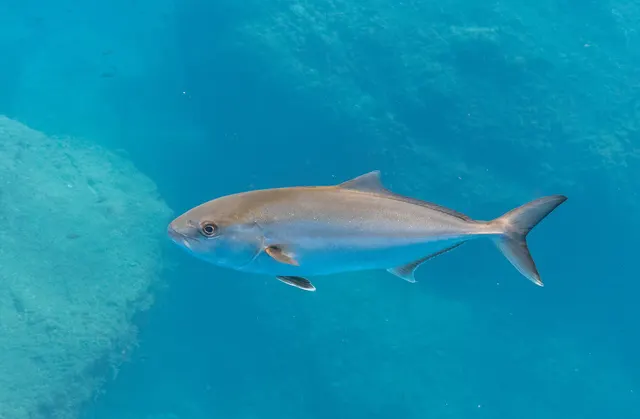
- Greater amberjackRecorded here1 placeTazacorte and Puerto NaosOver harbour wall
From a boat · 2
What these strengths mean
- Regular local target
- Fishing sources describe this as a normal local target here, not merely as caught.
- Recorded here
- At least one credible public account of this species being caught here. That is all it means.
- How breadth is counted
- A fish documented at six marks is shown as six marks: breadth never raises the strength on its own. A fishery account describes the fishing; a recorded catch reports one specific catch. How evidence is weighed.
Fish documented nearby, not here
Nothing below has been documented at Tazacorte and Puerto Naos itself. Each one has been documented at a named place on the same ground, and the places are listed with it. Treat this as what the water around here holds rather than as a catch list for this mark.
Also documented at neighbouring places
One or two accounts each, on the ground around here. Enough to know the fish is caught in these waters; not enough to say anything about this place.
From the shore
- Bogue — documented at Santa Cruz de La Palma
- Salema porgy — documented at Santa Cruz de La Palma
How people fish it
Practised here: Sea fishing.
Methods the sources name for this ground. Each one is explained in full on its own page.
- Float fishing
Suspending a bait at a controlled depth beneath a buoyant indicator — the most visual, most controllable and most widely applicable method in angling.
- Ledgering
Fishing a bait on the bottom held by a weight, with no float — the simplest way to fish at distance, in depth, or in wind.
- Jigging
Working a weighted lure with a rising-and-falling motion, usually vertically, so it behaves like a wounded or fleeing baitfish.
- Light rock fishing
Ultralight lure fishing from the shore with tackle rated in single grams — a discipline that catches the fish everybody else steps over, and one FishingHQ held every component of and had never named.
Baits and lures for these fish
The baits and lures each of the fish above is commonly taken on, from that fish’s own page. This is what works for the fish, not a report of what people use on this particular water — local knowledge and the conditions on the day still decide.
Lures
- Metal jigs — for Greater amberjack
The ground and the water
- The ground
- The island's only significant harbour, at the mouth of the Barranco de las Angustias, with a breakwater, black sand beaches either side and the ground falling to great depth within a very short distance of the mole.
- Exposure
- Open west to the Atlantic; the breakwater is the island's main shelter.
- Depth
- Water around fifteen hundred metres deep lies within a short run of this harbour, which is why the island's boat fishing works from it and why the deep species are reachable at all.
Getting there
What public sources describe, last checked 2026-08-26. Car parks fill, services change and a path existing is not a path anybody may use — none of this is a guarantee of availability and none of it is permission to be anywhere.
- Getting to it
- A working fishing and leisure port on the western coast of La Palma at the mouth of the Barranco de las Angustias, below the town of Tazacorte. The harbour authority states that the configuration of its internal jetties gives a high degree of shelter in the inner dock, which is where the sports craft and excursion boats lie.
Parking
Tazacorte harbour parking
Harbour or operator parking · Charging not established
The harbour authority lists a car park among the port's services without stating a capacity. Whether it is charged, and what part of it is public, are the operator's to state.
Where this access information comes from
- Puertos Canarios: the port file cards for Tenerife and the western islands — Puertos Canarios (Gobierno de Canarias) (Local authority, harbour or protected-area body)Relied on for: The regional harbour authority's own numbered file card for Tazacorte, giving the facilities, the car park and the regular services it operates.States this directlyPassage read and verified
What is there
Public toilets
Toilets and showers are listed among the port's services on the harbour authority's file card.
Drinking water
Potable water is listed among the port's services on the harbour authority's file card.
Food or shelter
A café operates at the port. Opening is the operator's business rather than the port's.
Harbour facilities
A working port with electricity and water on the quays, a fuel station, workshop services, waste collection, twenty-four-hour security, a shipping office and a dry dock with a six-tonne crane and a sixty-tonne travel lift. A seventy-two-member fishermen's association operates a point of first sale here — the largest documented on these islands.
Charter boats depart from here
Six boats offering sea excursions are recorded at the port by the harbour authority.
Through the year
Fished through the year, with the winter Atlantic swell the limiting condition on the open shore.
Safety
Cliffs and rock platforms — Can cause serious injury or death
Atlantic swell reaches the northern and western coasts with little energy lost, because there is no shelf to dissipate it. Waves at exposed lava platforms are larger and less predictable than the wind suggests, and people are washed off regularly.
What reduces it: Check swell rather than wind. Watch any platform for a sustained period before committing to it. Never fish a position you could not leave immediately, and treat undercut and blowhole ground as unsafe regardless of conditions.
Rules and access
FishingHQ does not know the current access position here. The Canary Islands are an autonomous community licensing their own recreational sea, boat and underwater fishing, separately from mainland Spain, and the archipelago carries marine reserves in which fishing and diving are restricted or prohibited on boundaries a visitor cannot see from the shore. Measures change. Check the current position with the Canarian government's fisheries administration before going.
Who holds the answer:
- The Canarian government's fisheries administration, which licenses recreational sea and underwater fishing in the archipelago.
- The island council, for local measures and for access to the coast.
- The marine reserve administration, where the water is inside a reserve.
- The regional Canarian government fisheries administration, for recreational licences, sizes and species rules
- The Spanish national maritime and fisheries authorities, for offshore and vessel matters
- The managing authority of any marine protected area or reserve, whose zoning governs what is permitted inside it
- Local dive centres, charter operators and clubs, for current practice and access on individual islands
Nearby fishing
Other publicly documented places within about 40 km, by distance. Positions are approximate public geography and are never exact marks.
- La Palma — 10–25 km · Island
- Santa Cruz de La Palma — 10–25 km · Harbour wall
- Punta de Fuencaliente, La Palma — 10–25 km · Rock platform
Sources for this place
- Sea Angler — Bauer Media (Specialist angling publication)Relied on for: Long-running published description of British sea angling practice by region, ground type and named mark.FishingHQ's interpretation of what it saysCitation checked — the work exists and is described correctly
- General angling website restatements of established technique — Various (Credible secondary source)Relied on for: Widely restated public descriptions of which places are conventionally fished and how, recorded as practitioner consensus rather than as scholarship, and not relied on for access, permission or any current rule.Background and mechanism onlyCitation checked — the work exists and is described correctly
- Canary Islands regional angling guidance sites — Various Canary-based angling and island guidance publishers (Credible secondary source)Relied on for: Canary shore angling practice: the species presented as ordinary local shore species, the techniques used from rock and mole, and the baits.States this directlyCitation checked — the work exists and is described correctly
- Puertos Canarios: the port file cards for Tenerife and the western islands — Puertos Canarios (Gobierno de Canarias) (Local authority, harbour or protected-area body)Relied on for: The regional harbour authority describing its own port: the facilities, the fuel station, the seventy-two-member fishermen's association and its own statement about the shelter of the inner dock.States this directlyPassage read and verified
How FishingHQ labels evidence is explained in the evidence policy. Last reviewed 2026-08-16.