The Derwent estuary
Estuary · Brackish water · in Australia
The estuary of the River Derwent at Hobart, fished from a long list of public shore spots on both banks, among them the Tasman Bridge, Sandy Bay, Taroona, Kingston, Blackmans Bay and the jetties at South Arm and Opossum Bay.
Safety: cliffs and rock platforms — can cause serious injury or death. One more point applies here.
FishingHQ describes what this place is, not whether you may fish it. Access, permits and who to ask.
What you can catch here
Documented at this place, grouped by how you would be fishing, with how strongly the sources support each one. This is what has been written down, not a forecast, and being listed is never permission to fish.
From the shore · 2
What these strengths mean
- Seasonal
- Well supported, and concentrated in part of the year rather than spread through it.
- Recorded here
- At least one credible public account of this species being caught here. That is all it means.
- How breadth is counted
- A fish documented at six marks is shown as six marks: breadth never raises the strength on its own. A fishery account describes the fishing; a recorded catch reports one specific catch. How evidence is weighed.
How people fish it
Practised here: Sea fishing.
Baits and lures for these fish
The baits and lures each of the fish above is commonly taken on, from that fish’s own page. This is what works for the fish, not a report of what people use on this particular water — local knowledge and the conditions on the day still decide.
Lures
- Metal jigs — for Yellowtail kingfish
- Surface lures — for Yellowtail kingfish
The ground and the water
- The ground
- The estuary of the River Derwent at Hobart, fished from a long list of public shore spots on both banks, among them the Tasman Bridge, Sandy Bay, Taroona, Kingston, Blackmans Bay and the jetties at South Arm and Opossum Bay.
Through the year
The state's guide records a summer run of yellowtail kingfish under the headlands, as far up as the Tasman Bridge.
Safety
Cliffs and rock platforms — Can cause serious injury or death
Ocean rock platforms are swept by unexpected large waves, and anglers are washed off and drowned. The sets that cause it are not visible from the platform in advance, and the escape route is usually upward and slow.
What reduces it: Never fish rock platforms alone. Watch a mark for a full set cycle before going on it. Wear a lifejacket — mandatory in some jurisdictions for exactly this reason. Wear footwear with grip on wet rock, plan the escape route before you start, and never turn your back on the sea.
Species that bite — Can cause serious injury or death
In the tropical north, saltwater crocodiles present a serious predation risk to people at the water's edge in estuaries, creeks and coastal areas — which is exactly where the fishing is.
What reduces it: Treat local signage and warnings as authoritative. Stay well back from the water's edge, do not clean fish at the water, do not enter the water, and vary your habits rather than fishing the same spot at the same time daily. This is a hazard where local knowledge is not optional.
Rules and access
FishingHQ does not know the current access position here. Tasmania sets its own sea fishing rules: bag, possession and size limits that differ by zone for some fish, a seasonal closure for at least one species, shark refuge areas where sharks, skates and rays may not be taken, marine reserves where no fishing is allowed, and licences for some kinds of gear. The state also publishes health advice against eating fish or shellfish from named estuaries. All of it changes. Check the current position with Fishing Tasmania before going. This water is tidal and transitional, so the freshwater regime may also apply above the tidal limit: FishingHQ does not know the current access position here. Tasmania licenses freshwater fishing separately from sea fishing, with its own seasons and waters. Check the current position with the state's fisheries authorities before going.
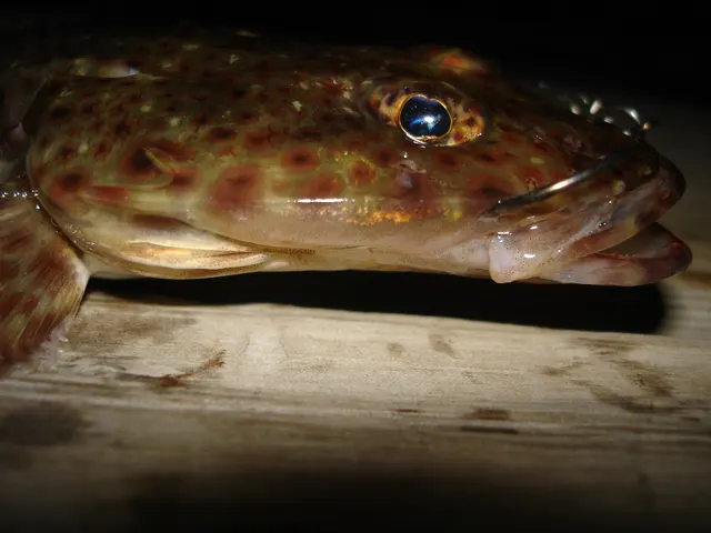
Particular to this water: The state's page says the River Derwent is a shark refuge area, where sharks, skates and rays other than elephantfish may not be taken, and it carries public-health advice not to eat shellfish or bream from the estuary, and to limit other fish, because of heavy metal contamination. The state's own species guide describes fishing for sand flathead as highly unsustainable in most of Tasmania and sets limits for it zone by zone. It asks anglers to fish for a mixed bag of other species instead.
Who holds the answer:
- Fishing Tasmania, the state government's recreational sea fishing service, which publishes the rules, area restrictions and seasons.
- The state public health service, for advice on eating fish and shellfish from particular waters.
- The Tasmanian Government's freshwater fishing licensing service.
- The fisheries agency of the specific state or territory — these are the primary authority and they differ from each other
- The federal fisheries authority for Commonwealth offshore fisheries and for protected species
- The managing authority of any marine park or protected area, whose zoning determines what is permitted where
- Local councils and land managers for access to particular shorelines and reserves
- Fishing Tasmania (Tasmanian Government): publishes the sea fishing rules, area restrictions and seasons for this water.
Sources for this place
- Fishing Tasmania: hot fishing spots, region by region — Tasmanian Government (Fishing Tasmania) (Government fisheries body)Relied on for: The Tasmanian Government's regional fishing page for this water: the popular public spots it names, what is caught from shore and from a boat, and the area restrictions it states.States this directlyPassage read and verified
How FishingHQ labels evidence is explained in the evidence policy. Last reviewed 2026-10-09.